Cold Front to Bring Gusty Winds, Thunderstorms, and Cooler Temperatures to Manatee County
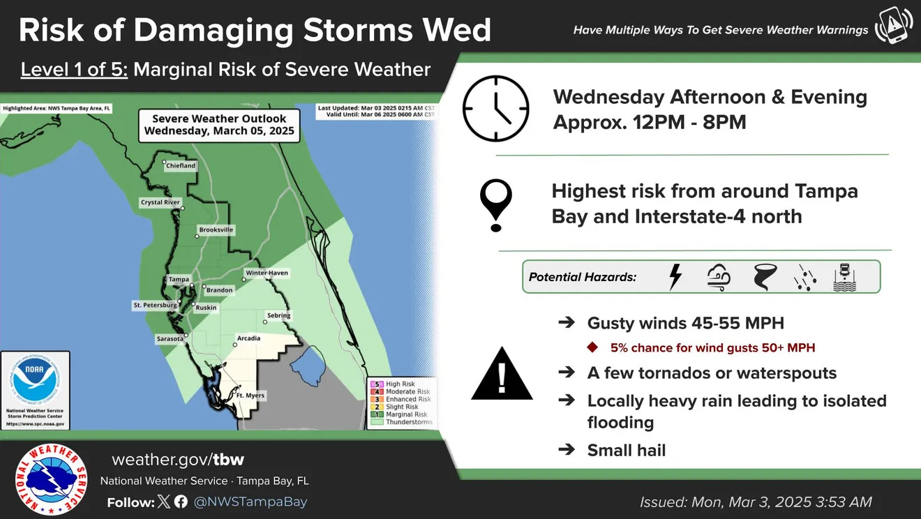
Manatee County residents should prepare for a shift in weather as a cold front moves into the area on Wednesday, bringing the potential for gusty winds, thunderstorms, and a significant temperature drop. While the most severe weather is expected to impact the Tampa Bay region, Sarasota and Manatee counties could still experience hazardous conditions, including winds reaching 45 to 55 mph, heavy rainfall, and the possibility of small hail or isolated tornadoes.
According to the National Weather Service, the weather system will push through the region between noon and 8 p.m. on Wednesday. Storm activity may be more intense north of Manatee County, but local residents should still expect periods of heavy rain and strong wind gusts.
Following the storm’s passage, temperatures are set to drop, with overnight lows expected to dip into the mid-to-upper 40s by Thursday night into Friday morning. Coastal areas may remain slightly warmer, closer to 50 degrees. Daytime highs are forecasted to stay in the upper 60s to low 70s.
Despite the midweek cooldown, conditions are expected to improve heading into the weekend. Beachgoers can anticipate sunshine and highs returning to the 80s on Saturday, though there remains a slight chance of rain.
Residents are advised to stay updated on weather alerts and exercise caution during the peak storm period on Wednesday.