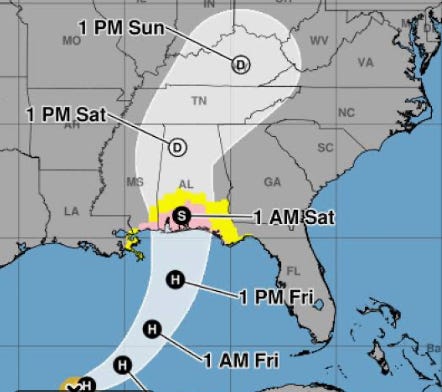
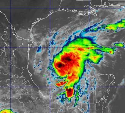
Hurricane Isaias strengthened into a Category 1 hurricane Thursday morning, October 8, as it continued moving toward the northern Gulf Coast, where damaging winds, heavy rainfall and dangerous storm surge are possible heading into the weekend.
According to the National Hurricane Center, Isaias had maximum sustained winds of 80 mph early Thursday and was moving east-northeast at 9 mph, approximately 420 miles south-southwest of the mouth of the Mississippi River.
Forecasters expect additional strengthening as the hurricane approaches the northern Gulf Coast late Friday or early Saturday. Hurricane and storm surge warnings have been reported along portions of the coast.
For Manatee and Sarasota counties, the projected track keeps the storm’s center well to the northwest. However, the Suncoast could still experience increased rain chances, gusty winds, rough Gulf waters and dangerous rip currents.
Beachgoers planning to visit Anna Maria Island, Lido Key or Siesta Key this weekend should monitor local beach conditions and warning flags. Rip currents can pose a serious threat even when a hurricane remains far offshore.
Forecasters continue to monitor Isaias through aircraft reconnaissance and updated weather models. Changes in the storm’s track or intensity could affect conditions along Florida’s Gulf Coast.
Residents are encouraged to review emergency supplies, including drinking water, batteries, medications and pet necessities, and monitor official weather updates throughout the weekend.
The Atlantic hurricane season continues through November 30.
Sources: The storm’s Thursday morning intensity, location and movement are confirmed by the National Hurricane Center’s 4 a.m. CDT advisory.